


Now Reading: Understanding Glacial Outburst Floods: Alaska’s Suicide Basin Unveiled
-
01
Understanding Glacial Outburst Floods: Alaska’s Suicide Basin Unveiled
Understanding Glacial Outburst Floods: Alaska’s Suicide Basin Unveiled
Fast Summary
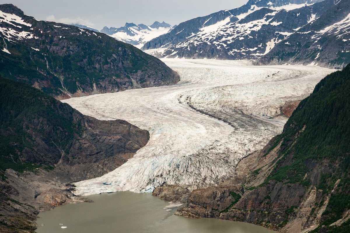
- A glacial lake outburst near the Mendenhall Glacier in Juneau, Alaska, has caused flooding in nearby neighborhoods. Authorities have issued evacuation notices for affected residents of the city.
- Meltwater is flowing from Suicide Basin, were water is dammed by the glacier, into the Mendenhall River and Mendenhall Lake downstream.
- On Wednesday morning (local time), water levels had reached 16.17 feet (4.93 meters), surpassing the previous flood record of 15.99 feet set in August 2024 during a similar event. Levels are predicted to peak at up to 16.75 feet (5.11 meters).
- Glacial outburst floods occur when ice dams fail suddenly, releasing large amounts of water unpredictably and without warning.
- A global study revealed that about 15 million people live in areas at risk of such floods; areas with heightened risks include India, Pakistan, China, and Peru due to their proximity to large glacial systems.
- Between 1990 and 2018, glacial lake volumes increased by about 48 percent as melting intensified due to climate change.
- Suicide Basin has experienced annual outburst floods since at least 2011; this marks a third consecutive year of record-breaking flood levels.
Indian Opinion Analysis
The increasing frequency and intensity of glacial lake outburst floods serve as a stark reminder of the wide-ranging impacts of climate change on vulnerable geographies worldwide-including India’s Himalayas which house numerous glaciers critical for regional ecosystems and livelihoods. India’s high-risk status highlights an urgent need for complete monitoring systems akin to those in Alaska’s Suicide Basin while fostering international cooperation on predictive analytics for such disasters.
With rapid urbanization along natural floodplains throughout India’s Himalayan belt and beyond-prompted partly by population pressure-effective early warning mechanisms can drastically reduce casualties when unpredictable flows threaten populated areas downriver.
Integration between science-driven data like satellite imaging studies alongside enduring growth planning could yield substantial safeguards against tragedies stemming directly or indirectly through mismanagement negligence overlooking risks posed disproportionately


Related Posts
Stay Informed With the Latest & Most Important News
Previous Post
Next Post


Advertisement


