

Now Reading: Coastal Districts Brace for Heavy Rain on Aug 19-20 Amid Bay of Bengal Depression
-
01
Coastal Districts Brace for Heavy Rain on Aug 19-20 Amid Bay of Bengal Depression
Rapid Summary
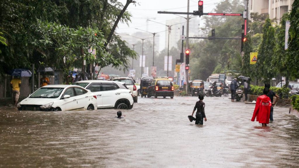
- The India Meteorological Department (IMD) issued a red alert for coastal areas of Andhra Pradesh due to a low-pressure system likely to intensify into a depression in the next 12 hours.
- Heavy rainfall is forecasted for August 19 and 20 in North Coastal Andhra Pradesh, with isolated extremely heavy rain expected. A pause in major rainfall activity is anticipated from August 22 to 25, though thunderstorms and strong winds may persist until august 23 across North Coastal and South Coastal Andhra Pradesh and also Rayalaseema.
- Rainfall data recorded between August 17 and August 18 showed extremes: alluri Sitarama Raju district received up to 16 cm (paderu), while Anakapalli district saw an average of around 10-14 cm in places like Chodavaram, Narsipatnam, yelamanchili.
- On Monday (August 18), real-time data indicated high rainfall at locations such as Maredumilli (72 mm), Gullasitharamapuram (65 mm), and Chintada (60.25 mm).
- A well-marked low-pressure system persists over west-central Bay of Bengal near north Andhra-south Odisha coasts with cyclonic circulation extending up to notable atmospheric levels. This system is expected to move west-northwestwards and cross south Odisha-north Andhra regions on the morning of August 19.
Indian Opinion Analysis
The IMD’s warnings align with robust atmospheric monitoring systems predicting localized extreme weather conditions during monsoon season.This red alert signifies potential disruptions across agriculture, transportation, or safety planning initiatives that must be proactively addressed by authorities in vulnerable regions like coastal districts prone to flooding or light infrastructure damage due to isolated heavy storms.
Importantly, detailed analytics such as station-wise rainfall breakdown emphasize the precision available now for regional disaster management responses-enabling targeted mitigation measures where risks are highest rather than blanket evacuations wich often spread resources thinly among varying seriousness zones overlapping state boundaries tightly managing efficiency aspects through coordination tasked heavily planners whether less frequentition){


Related Posts
Stay Informed With the Latest & Most Important News
Previous Post
Next Post


Advertisement


