
Now Reading: Georgia Beach Deploys High-Tech Solutions to Combat Erosion
-
01
Georgia Beach Deploys High-Tech Solutions to Combat Erosion
Quick Summary
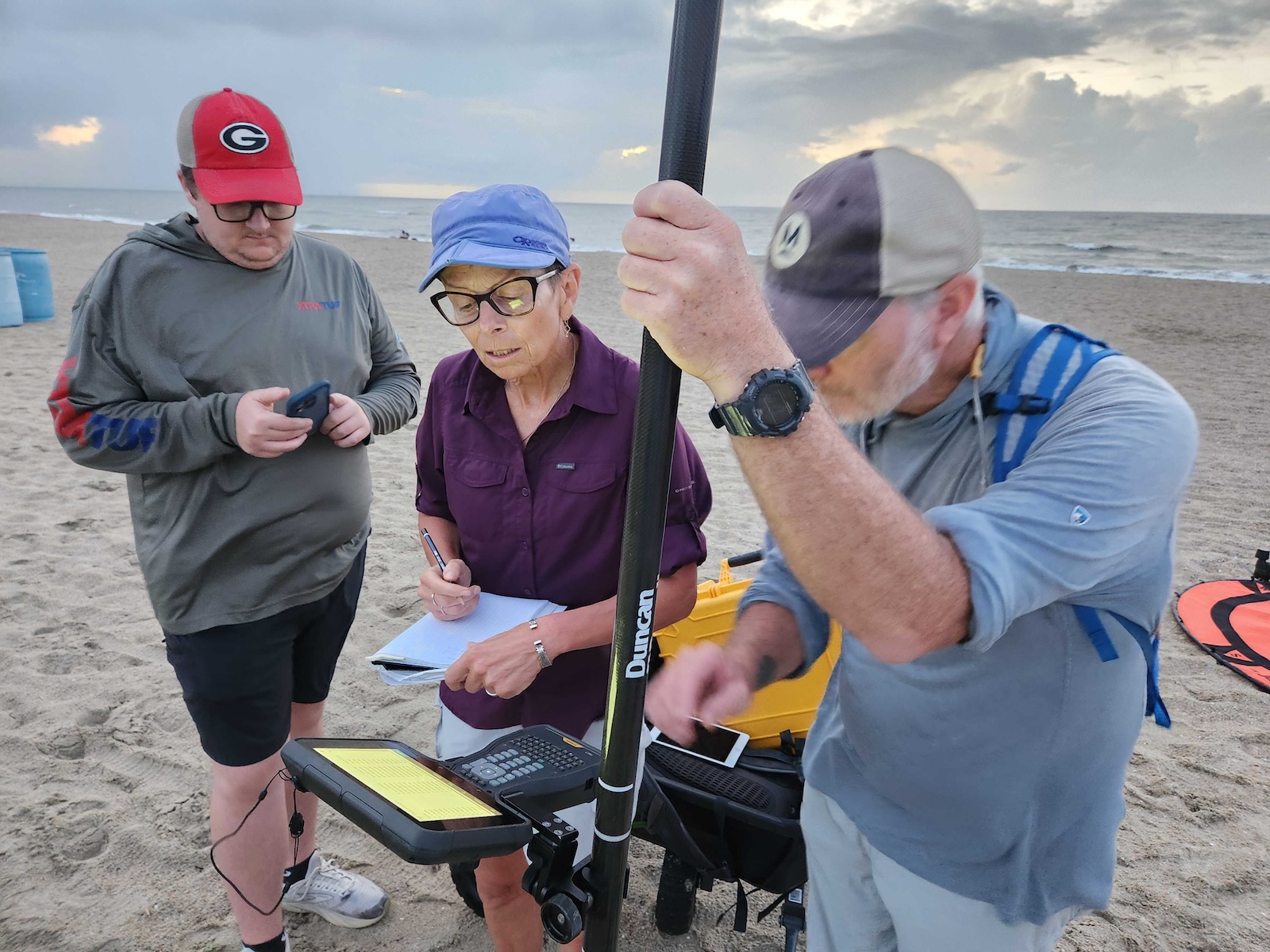
- Researchers from the University of Georgia’s skidaway Institute of Oceanography conduct quarterly drone surveys of Tybee Island, Georgia’s seven-mile beach using LiDAR technology.
- LiDAR provides detailed 3D elevation maps, enabling precise measurement of erosion and dune changes.
- The data helps local leaders and the Army Corps of Engineers plan beach renourishment projects effectively.
- As 1970s, Tybee Island has undergone regular sand dredging every seven years to combat erosion and maintain dunes and beaches for coastal protection.
- Granular data also reveals hotspots for erosion or accretion, aiding in targeted placement of renourished sand.
- research highlights advantages in using ocean-sourced sand as dunes hold together better with rooted vegetation compared to mainland-sourced sand.
Indian Opinion Analysis
While this story is specific to Tybee Island, Georgia, it underscores broader lessons about coastal resilience that may resonate with India’s own long coastline vulnerable to rising sea levels and erosion-from Gujarat’s mangrove shores to Odisha’s cyclone-hit coasts. High-resolution mapping technologies like LiDAR could enhance India’s ability to periodically capture precise environmental changes along its coasts-streamlining interventions such as mangrove replantation or artificial dune construction. Data-driven insights would not only improve efficiency in conservation projects but also bolster grant applications both domestically and internationally for climate resilience funding-a growing factor amidst the complexities of global warming affecting Indian subcontinent.


Related Posts


Stay Informed With the Latest & Most Important News
Previous Post
Next Post


Advertisement


