


Now Reading: Powerful Radar Satellite to Study Earth’s Movements and Quakes
1
-
01
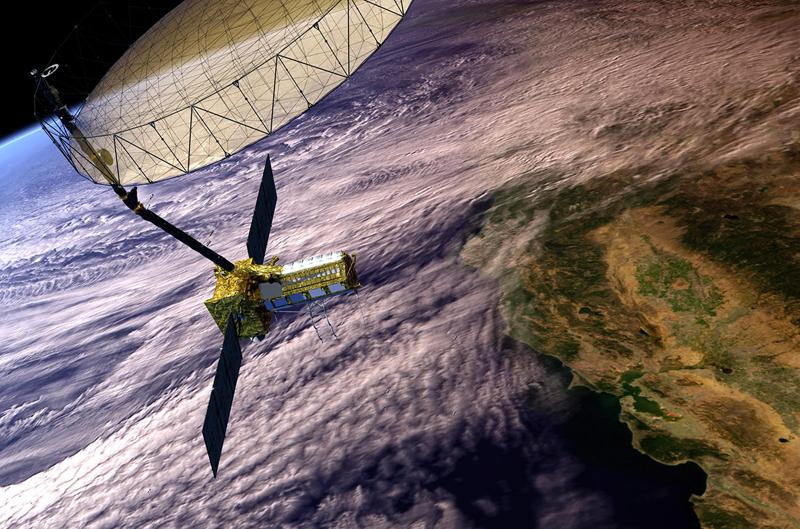
Powerful Radar Satellite to Study Earth’s Movements and Quakes
Fast Summary
- NASA and ISRO’s joint $1.5 billion NISAR mission involves a groundbreaking radar satellite designed to monitor Earth’s land and ice changes.
- The satellite uses advanced radar technology capable of producing detailed global time-lapse imagery to track environmental changes.
- NISAR will focus on key areas such as shifts in Earth’s surface, melting glaciers, and natural disasters like earthquakes.
Indian Opinion Analysis
The NISAR mission underscores India’s growing collaboration with international agencies like NASA in enterprising scientific endeavors. By leveraging cutting-edge radar satellite technology, this initiative has the potential to enhance global understanding of climate change, disaster response, and enduring land use – areas critical for both India and the planet at large. Furthermore, India maintains its role as a meaningful contributor to space research through ISRO’s involvement in such mega-projects, highlighting the country’s technological capabilities and commitment to addressing global challenges alongside othre nations.


Related Posts
Stay Informed With the Latest & Most Important News
Previous Post
Next Post


Donations


Advertisement

Loading Next Post...


