


Now Reading: New Satellite Tech Maps Wildfire Smoke in 3D for Localized Air Quality Alerts
-
01
New Satellite Tech Maps Wildfire Smoke in 3D for Localized Air Quality Alerts
Quick Summary
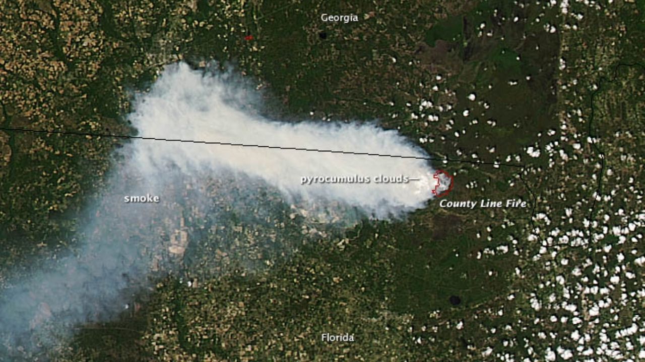
- Canada is experiencing another severe wildfire season, reminiscent of the record-breaking 2023 season that exposed millions in North America to hazardous smoke.
- Customary satellite tracking only provided a two-dimensional view of smoke plumes, without altitude data critical for assessing air quality impacts.
- A new satellite-based method using NASA’s TEMPO satellite provides a three-dimensional (3D) picture of smoke movement, enabling neighborhood-scale monitoring.
- TEMPO determines smoke plume altitudes by analyzing sunlight absorption at specific wavelengths. Plumes lower in the atmosphere pose greater health risks as they carry PM2.5 particles that exacerbate respiratory and cardiac conditions.
- the NOAA’s GOES-R satellites are combined with TEMPO data for near-real-time health risk assessments, though these systems can’t detect below cloud cover yet.
- Rising global temperatures and increased human encroachment into wildland areas have amplified wildfire risks across North America.
- wildfire-related pollution has reversed two decades’ worth of air quality improvements in parts of the western U.S., despite stringent emissions regulations elsewhere.
Indian Opinion Analysis
the advancements in monitoring wildfire smoke hold critical value globally, including for India-a nation facing its own challenges with air pollution exacerbated by stubble burning and forest fires during dry seasons. Improved air quality forecasting through 3D mapping could enhance public safety measures and aid policymakers worldwide to manage airborne pollutants more effectively.
For India, adopting or collaborating on such technologies could refine localized pollution interventions as part of ongoing efforts under initiatives like NCAP (National Clean air Programme). Moreover, this technology underscores how precise environmental data can inform public health responses amidst growing climate change-induced hazards-a shared global concern requiring collective action.


Related Posts
Stay Informed With the Latest & Most Important News
Previous Post
Next Post


Advertisement


