


Now Reading: NASA Publishes Comprehensive Land Motion Data for North America
-
01
NASA Publishes Comprehensive Land Motion Data for North America
Fast Summary
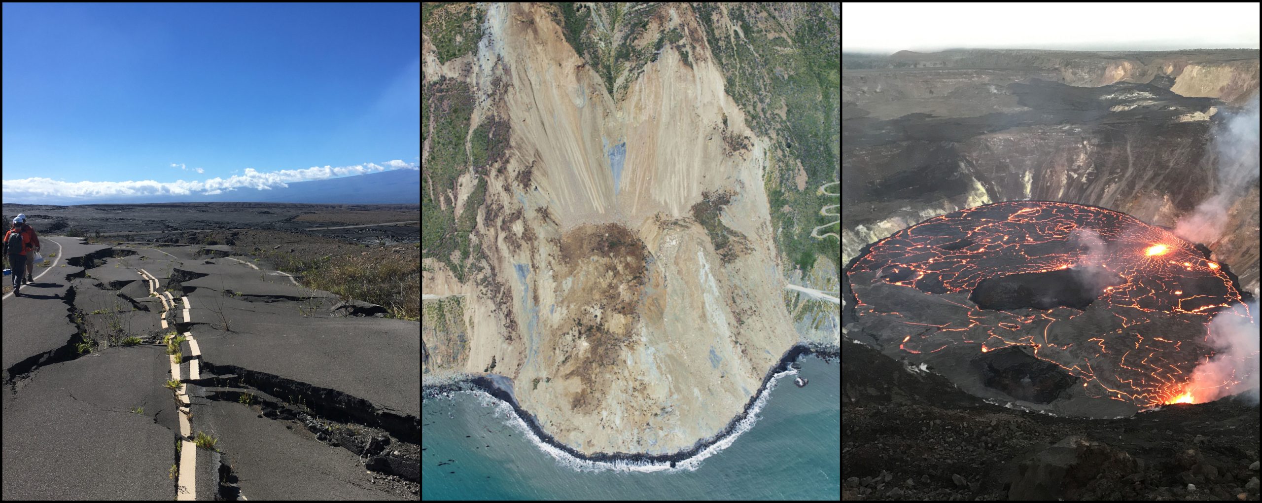
- NASA Collaboration: NASA and the Alaska Satellite facility have created a web-based tool to map land motion across North america,enabling non-experts to understand phenomena like earthquakes,landslides,subsidence,and resource extraction effects.
- OPERA Project: Led by NASA’s Jet Propulsion Laboratory (JPL), the Observational Products for End-Users from Remote Sensing Analysis (OPERA) project automates radar data processing using Synthetic Aperture Radars (SAR), improving accessibility for users without technical expertise.
- Features of the Portal: The online platform shows detailed land movement down to less than an inch since 2016. Users can zoom in from regional scales to a specific neighborhood level and visualize cumulative movements over time with simple interactive features.
- coverage Expansion Plan: Data currently covers U.S. locations such as New York City, Southwest U.S., northern Mexico. By 2025, coverage will expand across all U.S., Canada, Central America regions within 120 miles of the border.
- Data Sources: OPERA leverages ESA’s Sentinel-1 radar satellites launched in 2014; future data will incorporate NASA/ISRO’s NISAR satellite scheduled for launch this year.
- Use Cases: State geological surveys and agencies like Arizona Department of Water Resources can leverage datasets for localized analyses related to groundwater subsidence or hazards monitoring with faster access at reduced costs compared to traditional methods.
Indian Opinion Analysis
NASA’s development of an easy-to-use portal showcasing land motions has implications that extend internationally – including India – given its potential integration with ISRO technologies through NISAR collaboration. While primarily focused on North America currently, similar tools could prove invaluable in addressing India’s geo-environmental challenges such as ground subsidence caused by urbanization and over-extraction of water resources.
This initiative reflects advancements in making complex scientific processes accessible for widespread use – empowering not just researchers but also policymakers and communities facing environmental risks. As India strengthens its space technology capabilities through ISRO collaborations like NISAR, leveraging lessons from OPERA could enhance disaster preparedness systems by enabling quicker detection and mapping of critical events ranging from earthquakes to groundwater depletion.
Key takeaway: democratization of satellite data via platforms like OPERA fosters precision-driven policy decisions worldwide-India included-with benefits ranging from resource management optimization to improved disaster response strategies.


Related Posts


Stay Informed With the Latest & Most Important News
Previous Post
Next Post


Advertisement


