
Now Reading: Texas’ ‘Flash Flood Alley’: Geology Behind Its Deadly Risks
-
01
Texas’ ‘Flash Flood Alley’: Geology Behind Its Deadly Risks
Fast Summary
- Texas Hill Country, also known as Flash Flood Alley, is one of the deadliest areas in the U.S.for flash flooding due to its geography and geology.
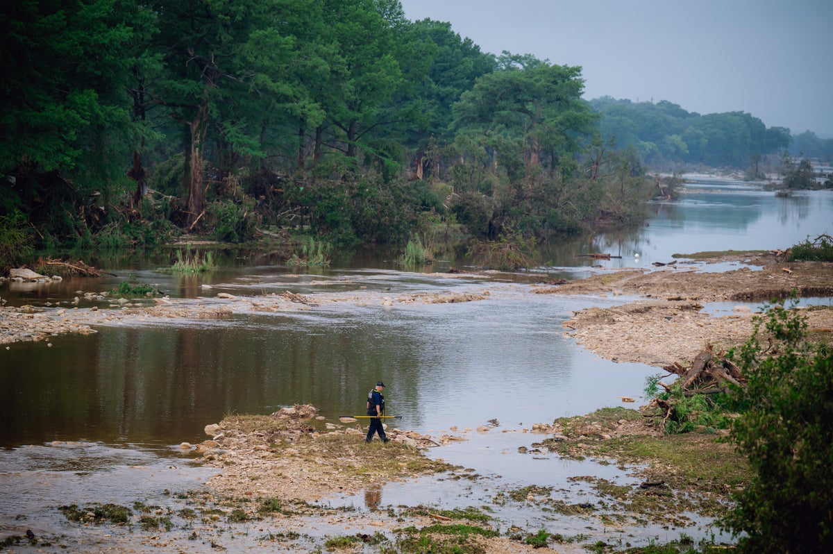
- On July 4, 2025, flash floods devastated Kerr County, about 70 miles northwest of San Antonio, killing at least 75 people and leaving many more missing.
- the Guadalupe River rose rapidly during the flood event-1 foot every five minutes at its peak-and eventually climbed over 20 feet by early morning.
- Ten girls from a nearby summer camp are still unaccounted for; deaths from this disaster have also been reported in adjacent counties.
- Factors contributing to the high flood risk in Hill Country include steep hillsides causing fast-moving water flow, semi-arid soil unable to absorb heavy rain quickly, and converging creeks creating surges that destroy homes and vehicles on their path.
- Historically notable floods have been recorded in the region-for example-in western Kerr County (1987) where similar events led to fatalities among teenagers evacuating campsites.
- Scientists note that climate change contributes to heavier downpours as rising temperatures allow increased atmospheric moisture retention.
Image: A man searches near Texas’s Guadalupe River after devastating floods raised death tolls.
Indian Opinion Analysis
flash flooding events such as those seen in Texas should be an important example for regions globally-including India-with comparable vulnerabilities like monsoon-induced river swells or urban inundation due to poor drainage systems. The rapid scaling of water levels highlights critical gaps between emergency preparedness and potential natural calamities intensified by geographic factors or climate shifts.
For India specifically-which witnesses damaging effects during monsoon onset-there are parallel lessons around integrating predictive technologies like probabilistic forecasting models alongside improved urban planning measures (e.g., structured barricades or evacuation readiness). Such initiatives mirror global practices but require tailored execution given India’s diversity of terrain and population density.Addressing infrastructure inadequacies while raising public awareness will be key in reducing future risks tied not just directly-linked safety hazards vehicle-specific read especially accident-prone mottos policies increases awareness signs spot efforts-focus entire interlink road weak responses harm-saving stakeholder engagement-expect learn-focused education


Related Posts


Stay Informed With the Latest & Most Important News
Previous Post
Next Post


Advertisement


